Main
I have developed this Lightroom plug-in, Reverse Geocode, to fill up the location
metadata of your photos using
existing coordinates information.
In order to find the information, we are using OpenStreetMap's Nominatim
search engine. All data are
© OpenStreeMap
contributors.
Lightroom provides that information; but that information cannot be applied over a
group of photos at the same time (at least I have not been able to do it in version 8.2).
Additionally, I have found that sometimes the process is far from complete and misses
some folders.
Plug-In installation
We download the file from this page.
- We move the downloaded file to our desired destination folder. Under
Windows we will need
to unzip the downloaded file.
- We go to Adobe Lightroom, then to the Plug-in Manager (located in the
File menu).
- Now, in the Plug-in Manager dialog, we click on Add.
- We choose the plugin file from the previous folder.
- Reverse Geocode is now ready to be used.
Updates
This plug-in is configured to look for updates automatically, if there is a new
version you will receive a
message with a link to download it.
To update the plug-in we just need to download the new version from this page;
then we replace the former plug-in in Finder (or in Windows Explorer) and finally restart
Adobe Lightroom.
PS: We may find the plug-in location in the Plug-in
Manager.
Running
To use the plug-in, we must select the photos which we want to update location information
in the Library view.
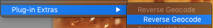
- Once selected, we go to Library menu, Plug-in Extras submenu and here we select
Reverse Geocode.
- If only one photo is selected the plug-in will run over all photos of the
working folder.
- Plug-in's start screen will indicate us the number of photos to be analyzed as
well as the fields
that will be checked.
- To start we just need to click on "Start".
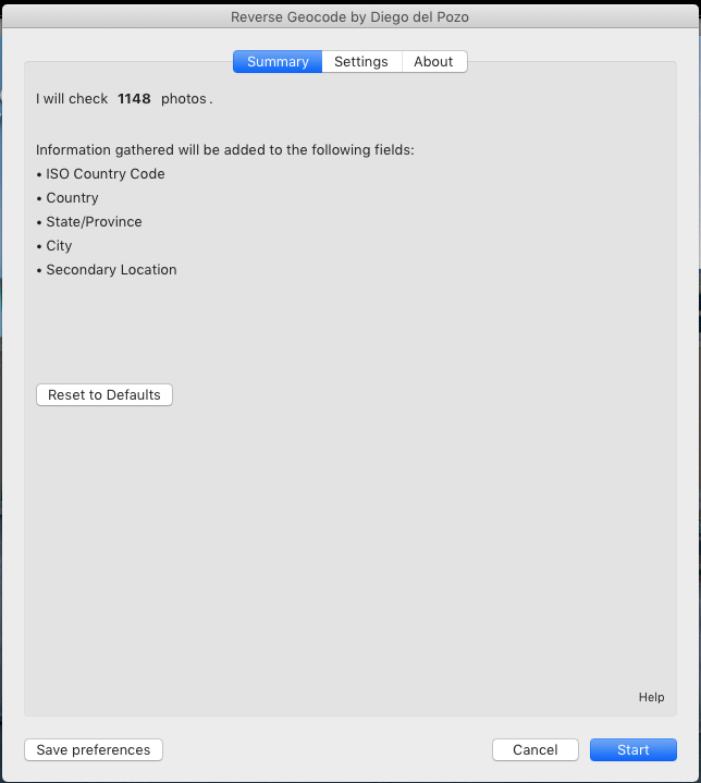
Using the default configuration, the plug-in will search for the following metadata
fields: City, State/Province, Country and ISO Country code. If there is any former
information in those fields, the existing values will be kept, filling only those
blank.
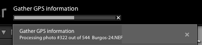
We can see the progress at the top left side of main window. We can keep on working
during the process.
Advanced options
In the Settings tab we may select the fields whose information we want to update. If
we want to replace existing
information, we will need to select the "Overwrite" option.
By clicking on "Save preferences" we will store our settings for future executions.
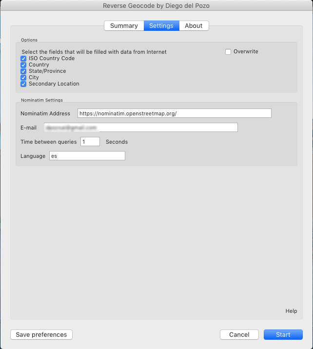
Reverse Geocode plug-in is based on OpenStreetMap nominatim API, that, in its
usage policy
, requires a maximum of 1 request per second.
You could use a different server that responds to the same API, e.g. downloading
information from
Openstreetmap and running nominatim over an own server. In this case you can type
your desired URL,
as well as modify the wait time between queries.
E-mail field, although not indicated in the usage policy, is defined in API
documentation. We recommend
our users that they type down their e-mail address here.
Search information is obtained, by default, using plug-in's language. You can change it
using an ISO code language string, as 'en' for English.
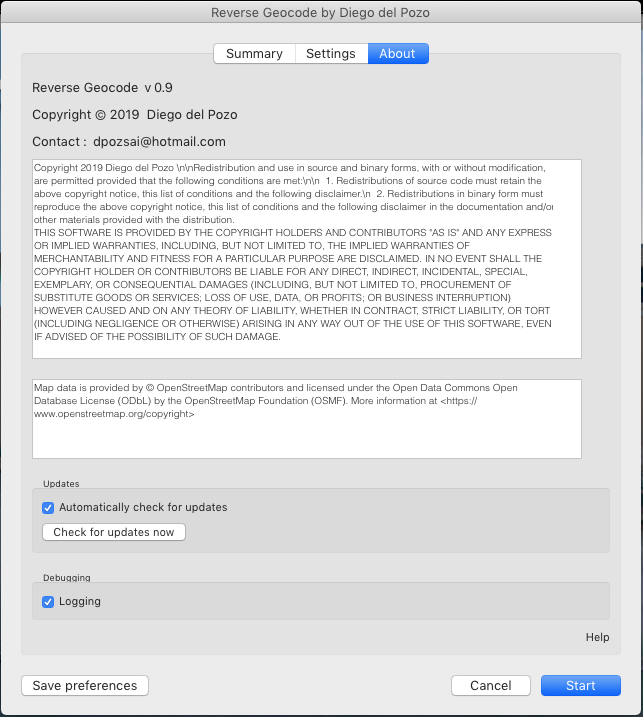
The About tab allows us to
- see license information
- deactivate automatic updates check,
- perform a manual update check and
- activate error debugging to the system console.
There is an absolute "no warranty" on this plug-in. Use it at your own risk.